Axis Surveys

Topographical Surveys

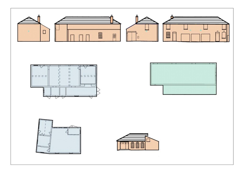
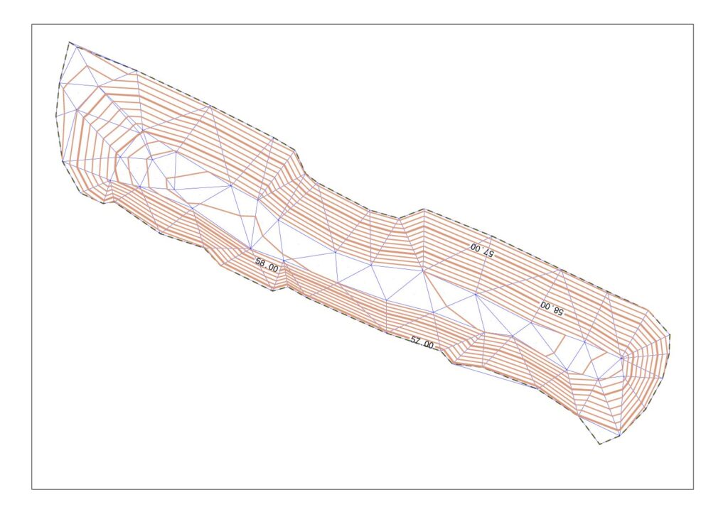
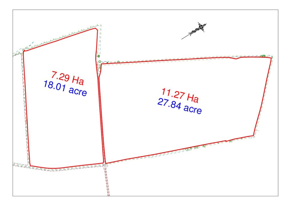
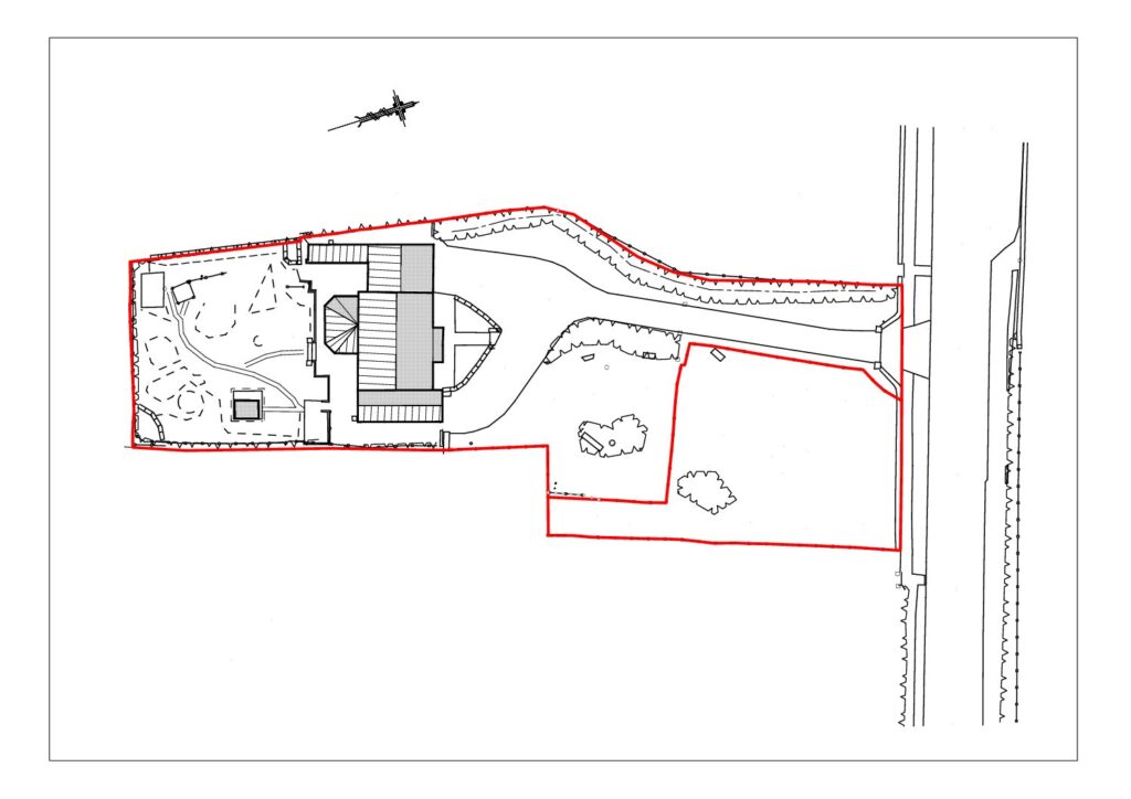
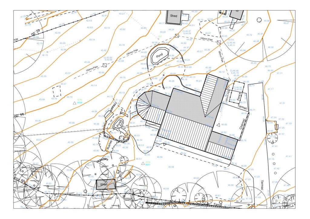
Topographical Surveys Topographical Surveys Axis Surveys Ltd. utilizes modern survey instrumentation to produce quality topographical surveys in a format to meet the client’s needs. Surveys can be related to the Ordnance Survey National Grid, and Ordnance Datum, using modern GNSS (Global Navigation Satellite System) equipment. Data Collection Equipment Topographic survey data is collected on site […]

Topographical Surveys Read More »

Volumetric Surveys

Volumetric Surveys Digital Terrain Models Volumetric survey data collected in the field can be processed to form a 3D Digital Terrain Model (DTM). The resulting DTM can form the basis for volume calculations, surface area measurements, contours and cross sections. The data contained in the computer generated Digital Terrain Model is extensive and eliminates the

Volumetric Surveys Read More »

Area Surveys

Area Surveys Area Surveys Area surveys can be undertaken to determine the area of a plot of land. Calculation of areas and dimensions may be required for a variety of reasons: Agricultural purposes, to comply with government requirements, grant applications or to monitor crop yields. For commercial purposes it may be necessary to determine areas

Area Surveys Read More »

Boundary Surveys

Boundary Surveys Boundary Disputes Boundary surveys may be required for various reasons: There can be a difference between physical boundaries on the ground and legal boundaries that exist in deeds and land registry documents. While solicitors are experts in the legal field, the advice and assistance of professional land surveyors can be invaluable in providing

Boundary Surveys Read More »

As Built Surveys

As Built Surveys As Built Surveys Building and construction projects develop in a number of stages from initial conception to completion. In the initial stages a topographical survey will ensure that the project gets started on the right footing. Volume survey calculations may be required during the tendering process or to monitor earthworks during the

As Built Surveys Read More »

Flood Risk Surveys

Flood Risk Surveys Land Surveys for Flood Risk Assessments Over recent years there has been a growing awareness about flooding, and the environmental impact on areas at risk. Some areas of the country are more at risk than others, but there is a general requirement to provide a flood risk for proposed developments, to satisfy

Flood Risk Surveys Read More »

Setting Out

Setting Out Service Setting Out Utilizing modern surveying equipment, setting out involves the establishment of markers on the ground. The clients design can be directly uploaded to surveying instruments to provide an efficient setting out partnership. Building and civil engineering projects, upon reaching the construction phase of the project, require setting out work on site,

Setting Out Read More »